Alaska is our biggest, buggiest, boggiest state. Texas remains our largest unfrozen state. But mountainous Utah, if ironed out flat, would take up more space on the map than either. --Edward Abbey
 |
| Quaking aspen (Populus tremuloides) is the best tree. |
Utah has 29 counties and 26 County
High Points (three are shared between counties) and it has the highest mean county
High Point in the entire United States. I just completed my goal of hiking to
the top of each high point in September 2023 after four years of off-and-on
diligence and I’m really proud of it! I’ve hiked and biked 281 miles up 75,518
vertical feet and fallen in love with so many new places. I tagged each summit
solo and now I’m ready to be more sociable.
I know it sounds preposterous, but I’m not much of a hiker,
I’m a schemer. I’m happy to literally ride my bike for days on end and I’ll ski
anywhere without complaint, but I only hike if it’s required to get me to some
other recreation destination (e.g., climbing) or if it’s part of a larger
traverse, circumnavigation, or link up. I ended an 8-year relationship in 2019
and it left me feeling like a failure. I interpreted every personal and professional
setback as one more thing I got wrong. I no longer had my primary climbing
partner, I'd stopped running due to a back injury, and I was desperate for
something that felt like success to fill the time I couldn’t spend on skis or
bikes. Shortly after my breakup I heard
about this County High Point goal from a friend of a friend and held it in the
corner of my mind until the snow melted. I didn’t realize until
now that having such a big goal filled a void in my life left by that
relationship and then embiggened by the COVID-19 quarantine.
The summits I got between 2013 and 2019 hold mostly serene
memories for me (2013-2016 = 4 summits, 2019 = 7 summits). Looking at my
pictures from all of 2020, it’s clear I spent that year running on adrenaline.
Afraid of getting COVID from a social situation and even more afraid of giving
COVID to a loved one, I just kept busy, but a safe busy because exposing
emergency responders to COVID was also bad (2020 = 6 summits). I didn’t slow
down until the fall when it was clear my mental and physical health needed some
care and I could ski again. 2021 was not my year: there was job
trauma, dating trauma, and I actually got COVID. I tagged no County High Points
but did have some excellent out-of-state adventures on the Grand Teton and in
Maine. I mark 2022 as the year I started to reclaim my health by going to all
the health care practitioners and taking up the High Points journey again, but with
bikes (4 new summits all with bike components). This year (2023) has been so
introspective, I’m constantly asking, “What am I doing? And why?” The most introspective
moments happened on the mountain. I got my final five county high points and my
dogs joined me for three of them! I even attempted a summit with my good
friends!
 |
| A full elk skeleton was one of the coolest finds hiking my #1 High Point - Bull Mountain |
In all this solo travel I’ve only learned two things. First,
express yourself! Telling a therapist what’s up, talking my way through scary
scrambles, or just telling a friend I’m in a bad place has made all the difference.
I’ve got a reputation for being independent but it’s mostly stubbornness.
Mountain journeys go faster and I make better decisions with company because I’m
expressing all the joy and trepidation I regularly feel. Second, the mountain
will always be there. Don’t make a dumb choice at high elevation just because
you made a plan. I ran into many instances where my Type-A personality was
driving me to get a summit just because I’d said I would. I didn’t want to let
snow, lightning, darkness, or disorientation get in my way. However, in talking
myself through things I could remember that the mountain will always be there
for another go, but I wouldn’t be if I died of exposure or electrocution.
The 26 County High Points are recounted in many good resources and listed alphabetically or by elevation. Rather than redoing what has already been done well, here I will list each summit in order of Sweetness. I’m a feelings person: the memory of my feelings lasts far longer than my memory of the route, so I’ll share a brief description of the vibe and a fun fact. Note that my definition of sweetness is often at odds with other sources on the internet and ranking 26 things becomes a bit arbitrary in the middle. Road Trip Ryan and High in Utah (Weibel and Miller, 1999) are both great resources for trip reports and summit instructions.
1. Bull Mountain (Raft River Range) – Box Elder County – 9,934 ft (3,720 ft prominence).
10.54-mile hike, 3,871 vertical feet
 |
| One of my hiking rules is to take pictures of every sego lily (Calochortus nutallii) because they are always beautiful and sometimes hide treasures like this green crab spider. |
 |
| The Bull Mountain cirque, very steep terrain just below a very flat summit. |
This corner of Utah drains into the Snake then Columbia River Basins, the rest of the state is part of the Great Basin and Colorado River drainages.
2. Mount Waas (La Sal Mountains) – Grand County – 12,331 ft.
8.41-mile hike, 3,427 vertical feet.
The La Sal Mountains might be my favorite range, they are so
beautiful and intimidating. Mount Waas took two tries three years apart and I
brought my dog on the redemption hike. They did so good! I, on the other hand, finally took a tumble on the talus. Turning back in 2020
was hard but helped me remember that the mountain will always be there for a
second try, but if I make bad choices I might not be.
 |
| Me and my Goodest Girls, Pippa and Francis, enjoying the summit of Mt. Waas. |
Waas is a Ute word that means chief or man. WAAS is also an aviation navigation system.
3. Deseret Peak (Stansbury Mountains) – Tooele County – 11,031 ft (5,811 ft prominence).
8-mile hike, 3,558 vertical feet
 |
| Deseret Peak from near the trailhead, such a striking mountain. |
 |
| The scar from the Painter Springs fire. The ashes looked like smoke when they caught a gust of wind. |
Captain Stansbury might be responsible for the spelling of Tooele when he tried to spell tule. Deseret is a Mormon word associated with honeybees (the original rise and grind culture) and the name of their proposed territory.
4. Mount Nebo (Wasatch Range) – Utah County – 11,928 ft (5,488 ft prominence).
9.28-mile hike, 3,905 vertical feet.
 |
| Proof that I have friends! |
 |
| A little delirious at the summit of Mt Nebo, and a little annoyed that the sign maker got the elevation wrong. |
Mt Nebo, Utah is named after the biblical Mt Nebo where Moses died. Mount Nebo, Jordan is a real place.
5. Ibapah Peak (Deep Creek Mountains) – Juab County – 12,087 ft (5,269 ft prominence).
12.58-mile hike, 5,611 vertical feet.
I spent much of 2011 staring at the Deep Creek mountains in
wonder. Preparing for camping in this remote part of the state is an effort in
itself. The hike was steep and the summit was windy, but there were also
fighter jets messing around near the summit and buzzing through the canyon.
Totally worth the effort.
 |
| Steep, rugged striking. I'm slow above 12,000 feet, but that's fine when I have views like this |
Ibapah is an Anglicized version of the Goshute word Ai-bim-pa ("white clay water"). Google Maps and I disagree on how to pronounce it.
6. Delano Peak (Tushar Mountains) – Beaver and Piute County – 12,169 ft (4,689 ft prominence).
4.99-mile hike (~1 mile hike-a-bike + crash-a-bike), 1,964 vertical feet
 |
| The Tushar Mountains are the 3rd highest range in Utah and very beautiful. |
Delano Peak is Named for Columbus Delano, Secretary of the Interior 1870-1875.
7. Mount Peale (La Sal Mountains) – San Juan County – 12,721 ft (6,161 ft prominence)
7.6-mile hike, 3,158 vertical feet
Another La Sal summit that took two tries. This range
humbles me so much, but I find comfort in the fact that the mountains hold no
malice, even if they are menacing. I did this trail as a loop with a fun scramble
across the ridge to Mount Tukuhnikivatz.
 |
| For a while I was doing yoga poses at each summit, I rethought that plan after nearly toppling over doing a crow pose on talus. |
Spanish explorers named the La Sal range The Salt Mountains in disbelief the white capped peaks were snow. Albert Peale was a mineralogist in 1875.
8. American Fork Twin Peaks (Wasatch Mountains) – Salt Lake County – 11,489 ft (3,649 ft prominence)
2.55-mile hike, 1,037 vertical feet
Some say riding the aerial tram up from the Snowbird base
area is cheating, but it's not a competition. The scramble across the sharp
quartzite was very fun, the snow-slicked talus slop to the summit was not.
Returning to an Oktoberfest beverage at Hidden Peak was delightful.
 |
| Fun, fun scrambling. And the smile of someone who didn't know what 2020 would bring. |
There are at least three "Twin Peaks" in the Salt Lake Valley (Broads Fork, American Fork, Avenues) and there are actually 3 peaks at AF Twin Peaks. Do better, mountain namers.
9. Signal Peak (Pine Valley Mountains) – Washington County – 10,365 ft (4,485 ft prominence)
19.18-mile bike + hike, 6,473 vertical feet
The Pine Valley Mountains are another striking desert range
I've stared at for a while. I took the steep trail from Leeds that included a
four-mile gravel bike to a campground that is almost always closed for fire
danger. The wildflowers blooming in the old burn scar were so delightful and I
loved the ascent from red rock desert, through scrub oak, then ponderosa pine
to mountain meadows. Got very lost descending from the flat, nondescript
summit.
 |
| You can see Zion National Park from the slopes of Signal Peak if you take the steep trail. |
Signal Peak is supposedly named because it was used as beacon for planes during WWII.
10. Willard Peak (Wasatch Mountains) – Weber County – 9,763 ft (3,244 ft prominence)
22.43-mile bike + hike, 4,813 vertical feet
I didn't want to hike Ben Lomond again, so I biked to the
ridgeline from the Mantua side. The gravel road sucked going up and down, but
there is some really fun single track between the road and the summit. The
views of GSL are unbeatable.
 |
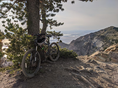
| My faithful rig Mags |
Willard Peak is the farthest north summit in the Wasatch. It is named for Willard Richards, an early Mormon leader, but they may have meant to apply that name to the more prominent Ben Lomond Peak.
11. Mount Naomi (Bear River Range) – Cache County – 9,979 ft (3,159 ft prominence)
31.36-mile hike, 9492 vertical feet (2-day backpack)
Mt Naomi is a Cache Valley classic and my first High Point.
The last time I hiked it was as part of a 30-mile partial traverse of the Bear
River Range from the Wind Caves to Cherry Peak. Learned a lot about proper
backpacking shoes by wearing running shoes.
 |
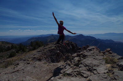
| For every picture of me jumping on a summit there are 5 more of me trying to take off or landing awkwardly. |
Mount Naomi is named for Ruth's mother in the Bible. I prefer to believe it was named for my niece, Naomi, who is great.
12. Mount Ellen (Henry Mountains) – Garfield County – 11,522 ft (5,842 ft prominence)
3.8-mile hike, 1,018 vertical feet
The Henry Mountains are so rad and I point them out whenever
I see them. My Mt Ellen summit was part of a scheme to tag the highest point of
3 laccolith mountain ranges in southern Utah (La Sal, Abajo, Henry) and the
only success. It's a delightful hike after a challenging drive. Didn't see any
bison.
 |
| Elated to be high in the Henry's |
The Henry Mountains are the most remote range in the lower 48 and the last to be mapped. The mountains support a buffalo herd that was introduced in 1941. Ellen was John Wesley Powell's sister.
13. Andy Nelson Peak (Markagunt Plateau) – Kane County – 10,027 ft
8.79-mile bike + hike, 1,336 vertical feet
The Virgin River Rim - Navajo Lake bike trail system is so
fun! Taking a detour on foot to bag this summit was pretty alright.
 |
| The technical term for single track like this is Sweet Sweet Nice. |
Navajo Lake below contributes to both the Sevier River/Great Basin drainage and the Virgin River/Colorado drainage. The primary water inflow and outflow is groundwater (sinkholes).
14. Thurston Peak (Wasatch Mountains) – Davis and Morgan County – 9,706 ft
9.33-mile hike, 2,253 vertical feet
Thurston Peak was the first in my dedicated scheme to bag
all the county High Points. It was fun to skip along the ridgeline from Francis
Peak to Thurston. Seeing the county I grew up in from above is always
something.
 |
| The Great Western Trail in Davis County is a delightful jaunt across the ridge line. |
Utah tourism will always remind you that the Wasatch Mountains are home to The Greatest Snow on Earth ™ and this summit places you within an easy drive of 11 resorts.
15. East Mountain (Wasatch Plateau) – Emery County – 10,743 ft
4.13-mile hike, 1,467 vertical feet
I hiked to this summit while I was reacting to an
interpersonal conflict and made poor navigation choices. I made this
significantly harder by simply bushwhacking uphill from my camp spot. There is
a trail to the summit that I took on the way down that is significantly easier
than cross country travel and the raspberries on the trail were ripe and
delicious.
 |
| Hiking in my pajamas. This is the only photo from this trip because I was in the beginning of my phone-wrecking phase (2019 to present). |
East Mountain is directly above the Crandall Canyon mine, the mine entrance is at 7,835 feet. The mine collapsed in 2007, killing 9 people.
16. South Tent Mountain (Wasatch Plateau) – Sanpete County – 11,285 ft (3365 ft prominence)
15.15-mile bike + hike, 2,070 vertical feet
My style is to make things as hard as possible, so this
summit was part of a Skyline Drive bikepacking scheme. This end of the drive is
beautiful with plenty of mountain meadows and the hike was a welcome reprieve
from pedaling.
 |
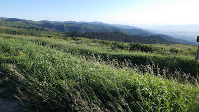
| A lot of the grassy ridges are terraced to prevent erosion caused by grazing. And there are still grazing animals, which feels bad to me. |
Probably got its name for being shaped like an old canvas tent, I'm happy the namers didn't call the north and south mountains Twin Peaks.
17. Fish Lake Hightop (Fish Lake Plateau) – Sevier County – 11,633 ft (4,153 ft prominence)
9.8-mile hike, 2,576 vertical feet
The trail to the Fish Lake Hightop is a practice in
extremes. The bottom half cuts steeply up the side of the plateau and the top
half meanders over the flat top. There were so many sheep and I had the tune
"Alexander Hamilton" stuck in my head the entire time. Did not love it
but didn't hate it.
 |
| I was grateful to have GPS coordinates on summits like these that are so broad and so flat. |
Pando, an aspen clone that is the largest organism on earth, is in the mountains next to Fish Lake (the lake, which is near the summit and within the national forest of the same name).
18. Gilbert Peak (Uinta Mountains) – Summit County – 13,442 ft
24.48-mile hike, 4,532 vertical feet
 |
| This hike was 80% off trail, but this cairn was one of only five total. |
 |
| Cottongrass (Erophorum scheuchzeri) in the most delightful alpine wetland. |
The Uinta’s are one of the few ranges in North America that run east and west and the range hosts ~2,000 lakes. Karl Gilbert was a geologist.
19. Kings Peak (Uinta Mountains) – Duchesne County – 13,528 ft (6,348 ft prominence)
32-mile hike, 4,084 vertical feet
 |
| My experience in the Uinta's is that the terrain is only ever flat or steep, there is no in between. |
 |
| Pretty elated to get this summit and to have someone there to take my picture. All other's here are selfies taken using a timer. |
King's Peak is also the Utah State High Point, but it was unknown if the north or south summits was highest until 1966. Clarence King was the first director of U.S. Geological Survey.
 |
| The benchmark summits look more impressive from afar than when you're on them. |
Daggett County is the least populous in Utah (935 people in 2020) and was established as a separate county from Uintah Co in 1917 because travel around the Uinta Mountains was so arduous. Use Uinta for geographic features, Uintah for political boundaries.
21. Mount Cardwell (Uinta Mountains) – Wasatch County – 10,743 ft
2.57-mile hike, 656 vertical feet
On this hike I got to the highest peak in Wasatch County and
the highest point, which is a spot on the flank of Murdock Mountain that the
county boundary crosses.
 |
| The highest point in Wasatch County near the highest summit |
The Salt Lake Tribune ran a contest in 1996 to name the unnamed county high points in Wasatch, Rich, and Kane Counties.
22. Bridger Peak (Bear River Range) – Rich County – 9,255 ft
2.3-mile hike, 982 vertical feet
I loved being back in the Bear River Range and enjoyed the
wildflowers, but there is very little else to speak of with this hike.
 |
| You can see Bear Lake from Bridger Peak, which is something to speak of. |
This peak was named for the explorer Jim Bridger. Three cities (WY, MT, and SD), two mountain ranges, a wilderness area, and a ski area are also named for him.
23. Brian Head (Markagunt Plateau) – Iron County – 11,307 ft (3,747 ft prominence)
5.15-mile bike, 809 vertical feet
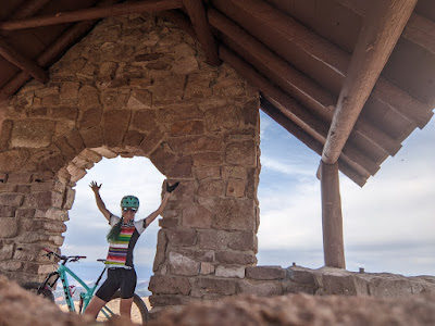
A road takes you to a parking lot and old CCC structure at
the summit, but I made it more challenging by biking instead of driving. It was
so unusual to have so many other people around for a high point, I'm usually
alone.
The Markagunt Plateau is a volcanic field that was active between 5.3 million years and 10,000 years ago. In the list of risky volcanic areas, the only worry about the Markagunt is that volcanic activity would disrupt the reservoirs in the area and block the highway to Brian Head.
24. Mine Camp Peak (Pahvant Range) – Millard County – 10,222 ft (3,001 ft prominence)
1.01 mile hike, 589 vertical feet
You can drive within a ha1.01-milef this summit, which I
chose to do over a 20-mile hike. However, I still made it difficult by bringing
the dogs, who did not like all the cows at the trailhead.
I found no information about the Pahvant Range, aside from its geological composition. The Pahvant Valley has several rock art and rock hounding locations.
25. Bluebell Knoll (Aquarius Plateau) – Wayne County – 11,328 ft (2,900 ft prominence).
1.11-mile hike, 182 vertical feet
The instructions I had said "Pick a rock, any
rock." The road to the top of the plateau runs within a quarter mile of
the summit, but I still got a mile of hiking in trying to find the right rock.
 |
| I think the view from Bluebell Knoll is better than the view of Bluebell Knoll. |
The Aquarius Plateau is the highest forested ("timbered") plateau in North America and sits above the highest "step" of the Grand Staircase.
26. Monument Peak (Wasatch Mountains) – Carbon County – 10,452 ft.
18.29-mile bike, 3,101 vertical feet
A gravel road takes you right to this summit, but I made the
journey harder by biking that road from the highway on a flat tire. Also, there
were scary sheep dogs.
Carbon County was settled in the 1870s and all the people
that moved in to participate in coal mining made it the most ethnically diverse
county in the state.
---
So, what now? It’s pretty exciting scheming up the next big thing. Maybe I’ll descend these summits on skis? Or try to reach the lowest point in each county? I’m most intrigued by trying to reach the highest point in each individual mountain range in the state (ohmygosh, the West Desert is going to be so cool). Or maybe I could tackle the slowest known time on the WURL? The possibilities are endless!


No comments:
Post a Comment